Massive underwater mountain discovered that is larger than some peaks in the Rockies
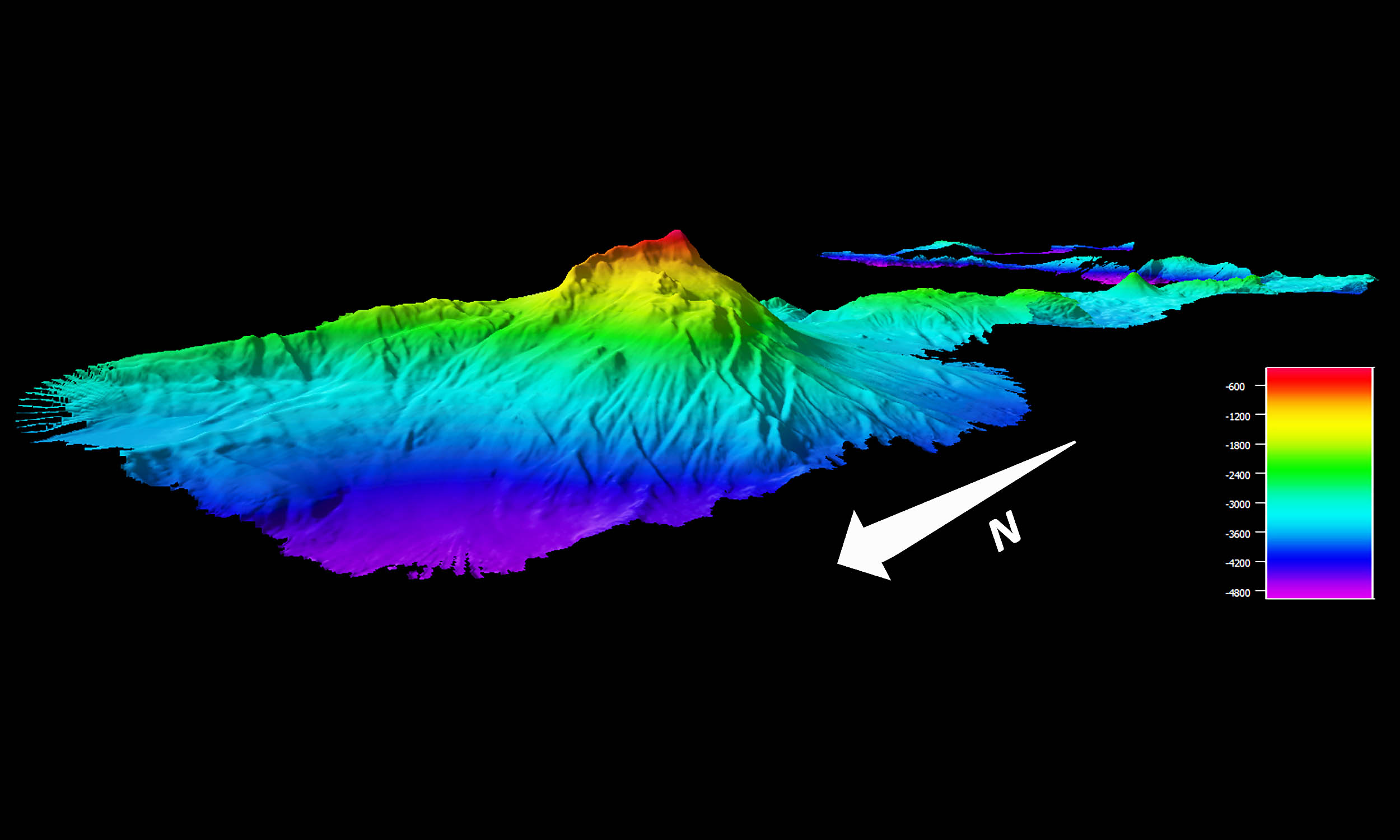
A mountain the size of a major Rocky Mountain peak is sitting under the Pacific Ocean north of Palau, and we finally have a map of it. The top rests about 800 feet below the surface, yet the whole structure climbs roughly 2.6 miles from the deep seafloor.
The discovery comes from a NOAA Ocean Exploration cruise that focused on a rarely mapped stretch of ocean. The team put time on task, swept the area with high resolution acoustics, and confirmed the feature’s size and shape.
Hidden ocean mountain discovered

The first public look at this feature appeared in a field log posted on September 2, 2025, which described the mountain about 250 miles north of Palau and noted its summit depth and scale. That early report also set the stage for future dives and sampling.
This account comes from Garret O’Donnell of NOAA Ocean Exploration, a 2025 John A. Knauss fellow aboard NOAA Ship Okeanos Explorer. He is part of the mapping team that turned raw sonar pings into a usable chart of the seamount.
“It’s funny to me that were we not actively mapping these features, we would have no idea that a mountain half the height of Mount Everest lies directly beneath us,” O’Donnell enthused.
“Maybe one day the map we made of this behemoth will be used to navigate the feature with a remotely operated vehicle to get a closer look.”
The numbers are straightforward and worth stating clearly. The peak sits about 800 feet down, and the full height from the abyssal plain to the summit is about 2.6 miles.
Why seamounts matter
A seamount is an underwater mountain, most often the remains of an extinct volcano that never broke the surface or later sank below the waves.
Less than one tenth of a percent of the world’s seamounts have been explored, a figure that captures how much frontier still exists in the deep ocean.
Scientists estimate there are more than 100,000 large seamounts on Earth when you count those taller than about 3,280 feet. That global count was formalized in a 2010 study that combined satellite and ship data to build a census.
Why do these mountains matter for life in the ocean? Their shape changes currents, concentrates food, and creates habitats that attract fish, corals, and marine mammals.
This point was underscored by NOAA’s national marine sanctuaries team in a 2025 explainer on why seamounts matter.
The new map north of Palau gives researchers a fixed target for future biological work. It also gives navigators and managers a better picture of the seafloor in a region where charts can still be sparse.
Mapping the new ocean mountain
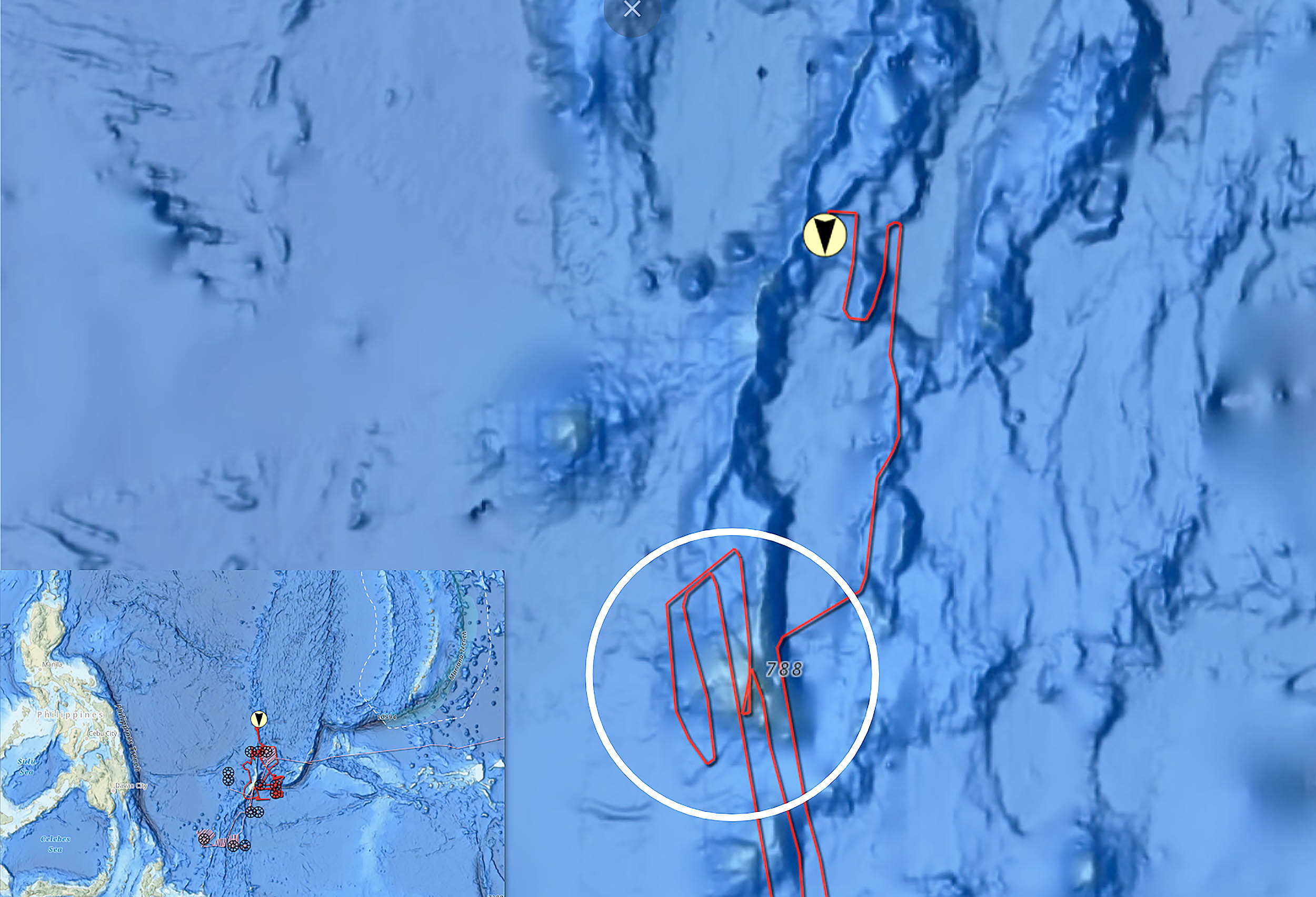
The workhorse tool was multibeam sonar, an array that sends out many sound beams and times their echoes to build a detailed picture of the seafloor.
Each pass traces a swath under the ship, and careful overlapping tracks stitch those swaths into a complete map.
Teams call the survey pattern “mowing the lawn,” because it is an even, methodical sweep that favors coverage and consistency.
That approach is slow, but it is the way to find steep slopes, ledges, and summit shapes that single passes can miss.
Precision matters, so crews run regular checks to keep the data within tight error limits. When the seas cooperate, this produces clean coverage that captures the real outline of a feature rather than a guess based on sparse lines.
Palau sanctuary setting
The mountain rises inside waters tied to the Palau National Marine Sanctuary, a policy that closed about 80 percent of the nation’s exclusive economic zone to extractive activity on January 1, 2020.
This makes the area a natural lab for documenting geology and life with less pressure from fishing.
Palau’s sanctuary sits near deep water that drops quickly from the island shelf. That geography lets research ships reach study sites in hours rather than days, which helps when a weather window appears.
Protected status also changes the kinds of questions teams can ask. With a baseline in place, future work can track how untouched seamount habitats function over time.
Explaining the size
The summit at roughly 800 feet makes this feature accessible to surface ship sensors and, with the right systems, to human tended or autonomous vehicles.
The full height of about 2.6 miles shows it is not a small bump, but a major structure that would not look out of place among prominent continental peaks.
For context, that height is in the same league as well known mountains on land. The comparison helps illustrate how much topography is hiding in plain sight beneath open water.
Ocean mountain maps matter
A remotely operated vehicle (ROV) can now be guided to interesting ledges and slopes rather than wandering.
Targeted transects can record sponge and coral communities, fish schools, and any signs of mineral crusts that often coat old volcanic rock.
Water sampling can pair with environmental DNA (eDNA) analysis to list species without seeing them directly. Those data can set a baseline for the site, which is essential for tracking change.
Good bathymetry improves navigation by reducing the chance of surprise shallows or pinnacles near shipping routes.
It also makes tsunami and circulation models more accurate, since seafloor shape affects how waves and currents move energy.
For research planning, a complete map is the difference between blind searching and directed work. It saves days of ship time and compresses campaigns into focused operations.
Future seamount mapping
The expedition that produced this map connects to a larger push to chart and understand Palau’s deeper waters.
NOAA has outlined a multi-cruise plan in the region, working with local partners to collect high resolution mapping data across the sanctuary.
Each new map reduces uncertainty and opens the door to more detailed work. It is a steady build toward a fuller view of the Pacific floor near Palau.
The global picture still frames the task. A widely cited census estimated more than 100,000 large seamounts worldwide, which shows how much there is left to find and study.
—–
Like what you read? Subscribe to our newsletter for engaging articles, exclusive content, and the latest updates.
Check us out on EarthSnap, a free app brought to you by Eric Ralls and Earth.com.
—–


News coming your way