Toxic ‘forever chemical' sites severely underestimated in the U.S.
PFAS – short for per- and polyfluoroalkyl substances – are so common that they’ve earned the nickname “forever chemicals.” They’re in rain jackets, dental floss, and even the sticky side of a bandage. Too often, they’re also in drinking water.
For years, U.S. contamination maps showed clusters of problem spots in places like California, Michigan, and New England. But those dots didn’t necessarily reveal where PFAS actually are – they only marked where testing had happened.

Now, researchers at Northeastern University’s PFAS Project Lab have redrawn the picture. Their new analysis suggests that while roughly 2,200 sites have confirmed contamination, as many as 80,000 more are likely polluted but untested.
The result is what the team calls the most complete snapshot yet – a tool designed to help regulators and communities figure out where to look next.
Presumptive PFAS sites fill the map
Because PFAS testing in the U.S. is spotty and often driven by state programs or local advocacy, the “known” map has always been incomplete.
To bridge that gap, the team built a model that flags “presumptive” contamination sites based on what those facilities do. If a type of place is well documented as a PFAS emitter, similar facilities elsewhere likely pose the same risk.
The approach flips the script: instead of waiting for sampling to reveal bad news one neighborhood at a time, it directs investigators toward the most probable sources before problems spread further.
Groundwater reveals contamination
When the researchers looked closely at the 2,200 verified sites, the picture was grim. Ninety-four percent of the locations with groundwater data had average PFAS concentrations above accepted regulatory levels.
Kimberly Garrett is the lead author of the study and a postdoctoral fellow at the PFAS Project Lab.
“We did find that, overall, all of the sites that we knew about had elevated PFAS concentrations that were above health-based guidelines,” said Garrett. “Some were associated with really high values, but they were all associated with unacceptable values.”
That matters for more than just the communities adjacent to those dots. PFAS contamination moves – through industrial waste streams, municipal wastewater systems, biosolids applied to fields, and rivers that cross county and state lines. Knowing where it likely starts is the key to cutting it off.
Foam linked to high PFAS
To make the presumptive map, the team sorted potential sources into categories. These included airports, military installations, industrial facilities, municipal fire activities, and wastewater treatment plants. They then compared how often and how strongly PFAS turned up.
Three stood out again and again: airports, military sites, and municipal fire activities. The common thread is aqueous film-forming foam (AFFF), a firefighting foam historically loaded with PFAS. Foam used in training and emergency response can soak into soil and groundwater or run off into nearby waterways.
“AFFF was consistently connected to the highest average PFAS concentrations,” Garrett said – a pattern researchers and regulators have suspected for years, now mapped at a national scale.
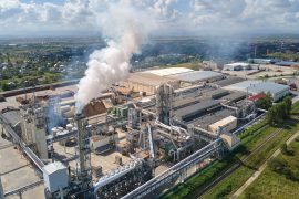
Factories tied to PFAS leaks
Beyond firefighting, the lab’s latest updates begin to tease out which industrial operations are most associated with PFAS releases. Metal manufacturing and electronics manufacturing emerged as frequent suspects.
“Metal manufacturers and electronic manufacturers could use a little more scrutiny in that area, especially as we think about making investments in semiconductor manufacturing and things like that,” Garrett said.
The point isn’t to halt innovation; it’s to ensure new industrial growth doesn’t lock in another generation of contamination.
Fixing PFAS starts upstream
Public conversation around PFAS often zeroes in on drinking water and wastewater utilities – logical endpoints where contamination becomes visible. But those facilities are downstream.
They inherit what industries and other emitters send them. Treating the problem at the end of the pipe is far harder and more expensive than preventing it in the first place.
“Turning off the tap of PFAS starts at the source,” said Garrett. “We can’t discount the industrial contributions to PFAS contamination.”
Phil Brown, the lab’s co-director, frames it as following the waste stream: identify the treatment plant, then look upstream for likely users and manufacturers.
“We can then tell them that they have to cut down their emissions before it gets into our plants,” he said.
A triage plan for limited budgets
Testing is costly, and agencies and utilities have finite staff and funds. The new map is designed with that reality in mind.
By highlighting presumptive hotspots, it helps decision-makers prioritize where sampling will have the biggest payoff. It also indicates where interim protections might be warranted. In some cases, this could mean providing alternative water sources while testing ramps up.
“We know that resources for testing bodies and regulatory bodies and municipal utilities are very limited,” said Garrett.
“So we hope that our tools can serve as a guide for if a municipality or a state has so much money for testing and they say, what would be the most impactful way to use this? We think that this paper can contribute to those decisions.”
From scattered dots to a strategy
PFAS are called forever chemicals because their carbon-fluorine bonds don’t readily break down. That persistence has made them useful – in nonstick coatings, waterproof gear, and industrial processes – and a nightmare to clean up once they escape into the environment.
The Northeastern team’s work doesn’t solve PFAS pollution, but it does something essential: it replaces a misleading patchwork of test results with a forward-looking map of risk.
The takeaway is not simply that PFAS sites are widespread; it’s that the problem has a pattern. Airports, military bases, and firefighting sites are likely hotspots. Certain industries deserve closer scrutiny. And the most efficient path to safer water starts upstream, before PFAS reach the taps.
The study is published in the journal Environmental Science & Technology.
—–
Like what you read? Subscribe to our newsletter for engaging articles, exclusive content, and the latest updates.
Check us out on EarthSnap, a free app brought to you by Eric Ralls and Earth.com.
—–


News coming your way